Case Studies
Recent Work
The four projects below demonstrate how transport planning and Geospatial services are applied in real planning scenarios. Each example shows how constraints are identified, issues are resolved and solutions are developed to support planning applications.
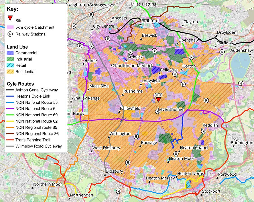
Example 1: Choosing the Best Locations for Diagnostic Facilities
The Challenge
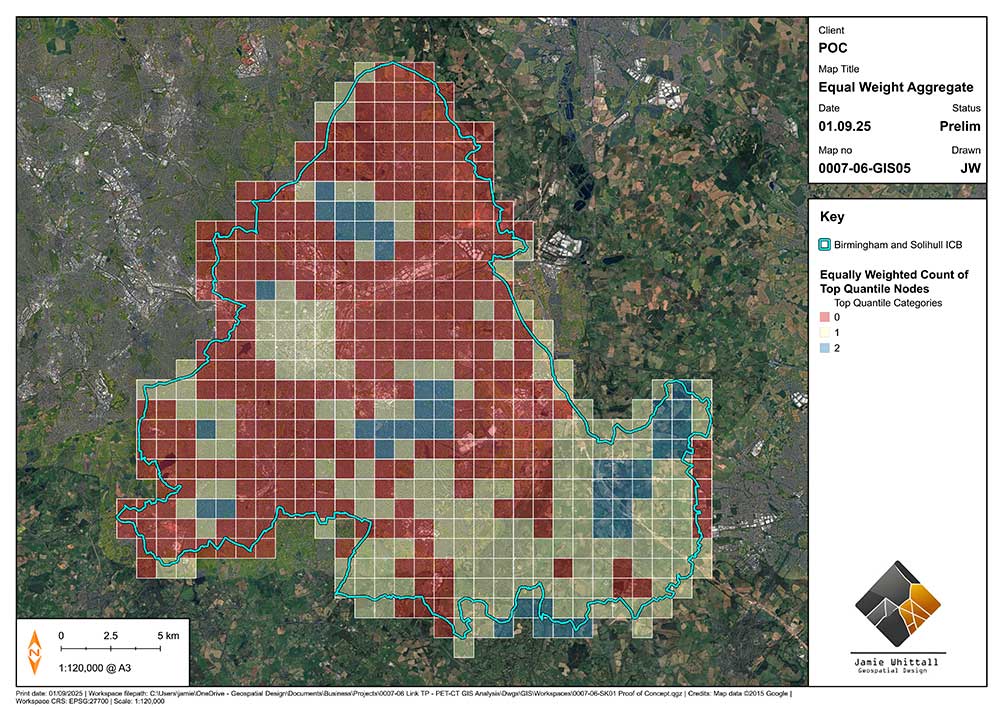
As part of a competitive healthcare bid, my collaborator Link Transport Planning needed to answer the question: “Where should new diagnostic facilities be located to help the most people?”
Because different areas have different health needs, population sizes and levels of access, the bid required a repeatable and simple way to compare locations.
The Approach
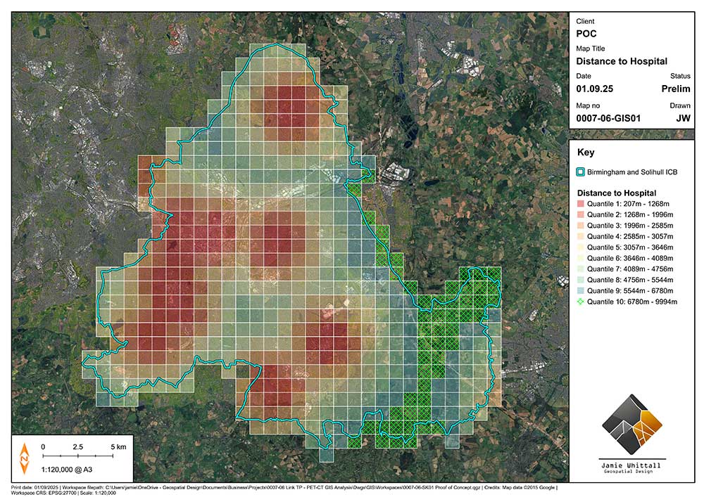
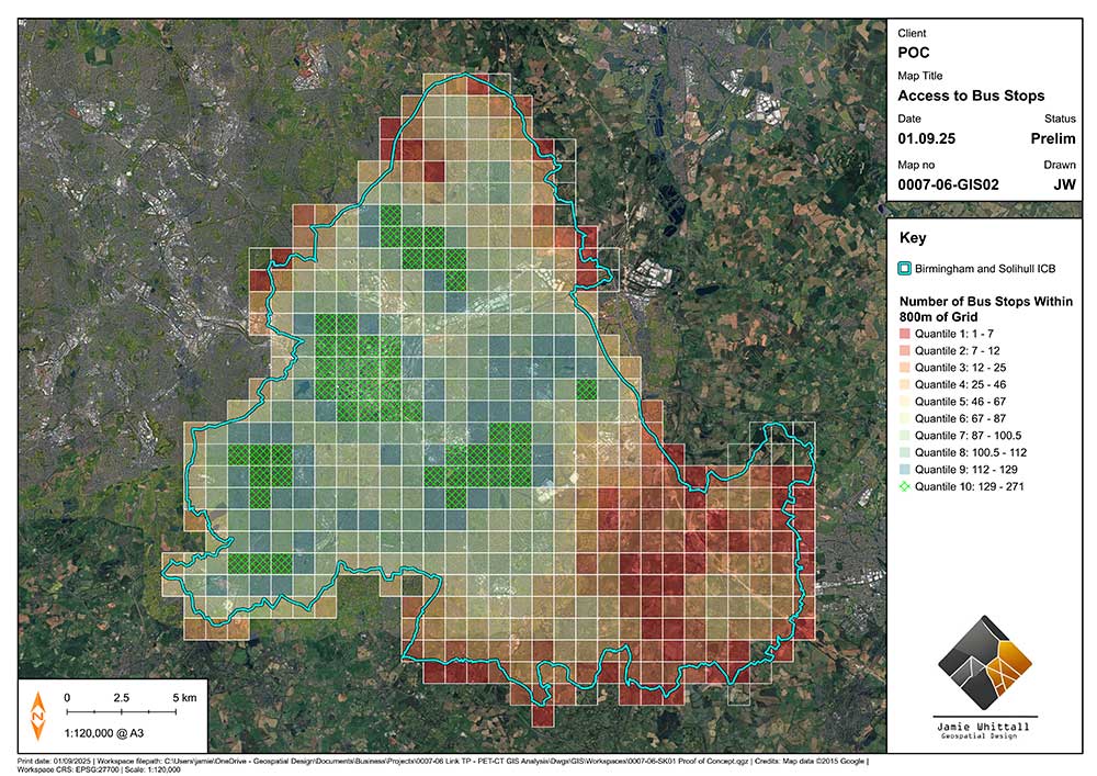
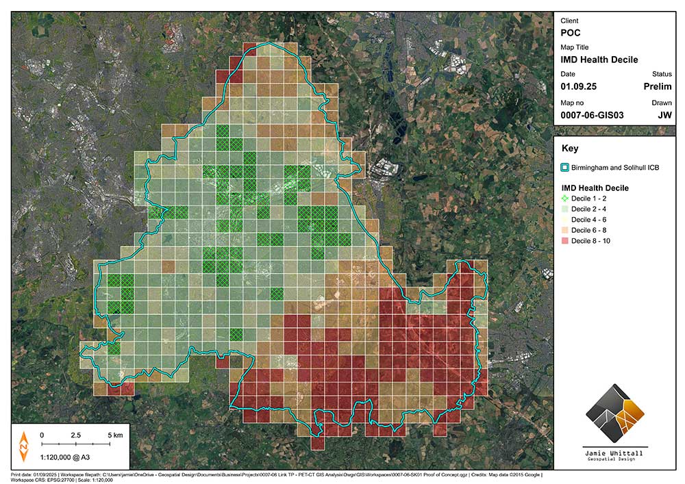
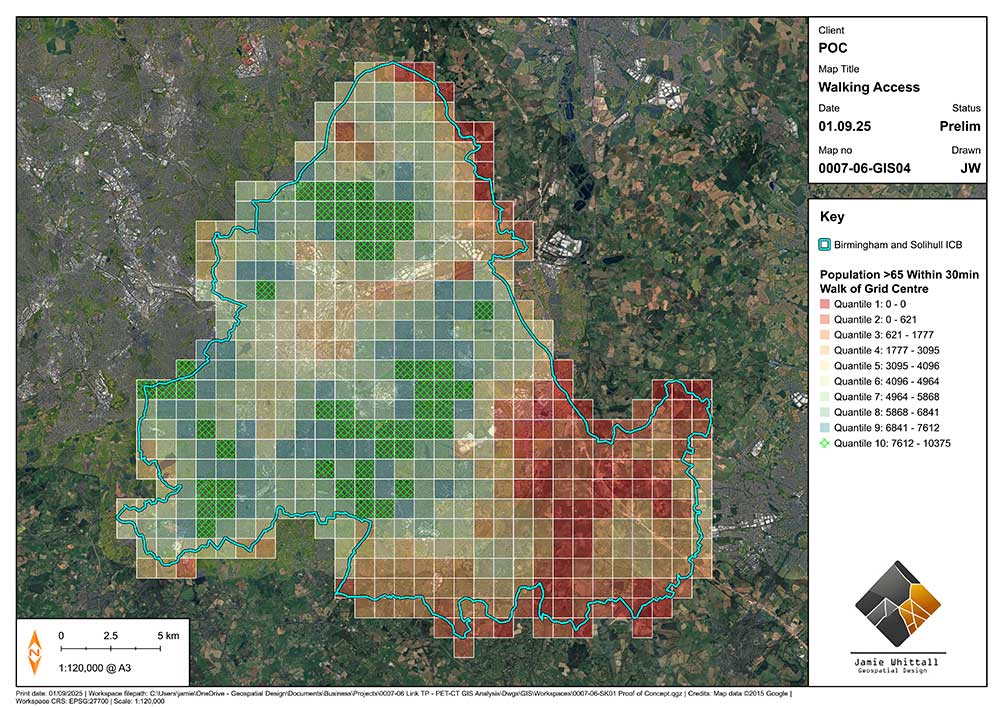
I created a mapping method that highlighted areas with the poorest access and the greatest need. For each part of the region, I considered distance to the nearest healthcare site, public transport access, local health challenges, and demographics. This gave the bid team a solid, easy-to-understand method that they could replicate for any healthcare region in the UK.
The Outcome
The region was divided into 1km map squares, each assessed using the same set of factors. Areas with poorer access or higher need received higher scores. When mapped, these scores highlighted clear “hotspot” locations where new facilities would make the biggest difference.
Finally, it was a case of turning the workflow into a QGIS model so that it could be ran as a program with minimal input and reproducible results.
The Work
The Client
“Jamie’s work gave us a straightforward, repeatable process that we can apply to any region. It was easy to follow, easy to justify and required very little input from me once he understood the brief. He just got on with it and delivered exactly what we needed. It strengthened the bid by showing that our approach can scale without being redesigned each time, and it’s something we’ll definitely use again.”
Joseph Cassinelli (Director – Link Transport Planning)
Example 2: Access to Constrained Sites
The Challenge
This project forms part of a wider programme of residential schemes I am involved in, with Oakwood Planning & Design, where creative access solutions are needed to unlock constrained sites.
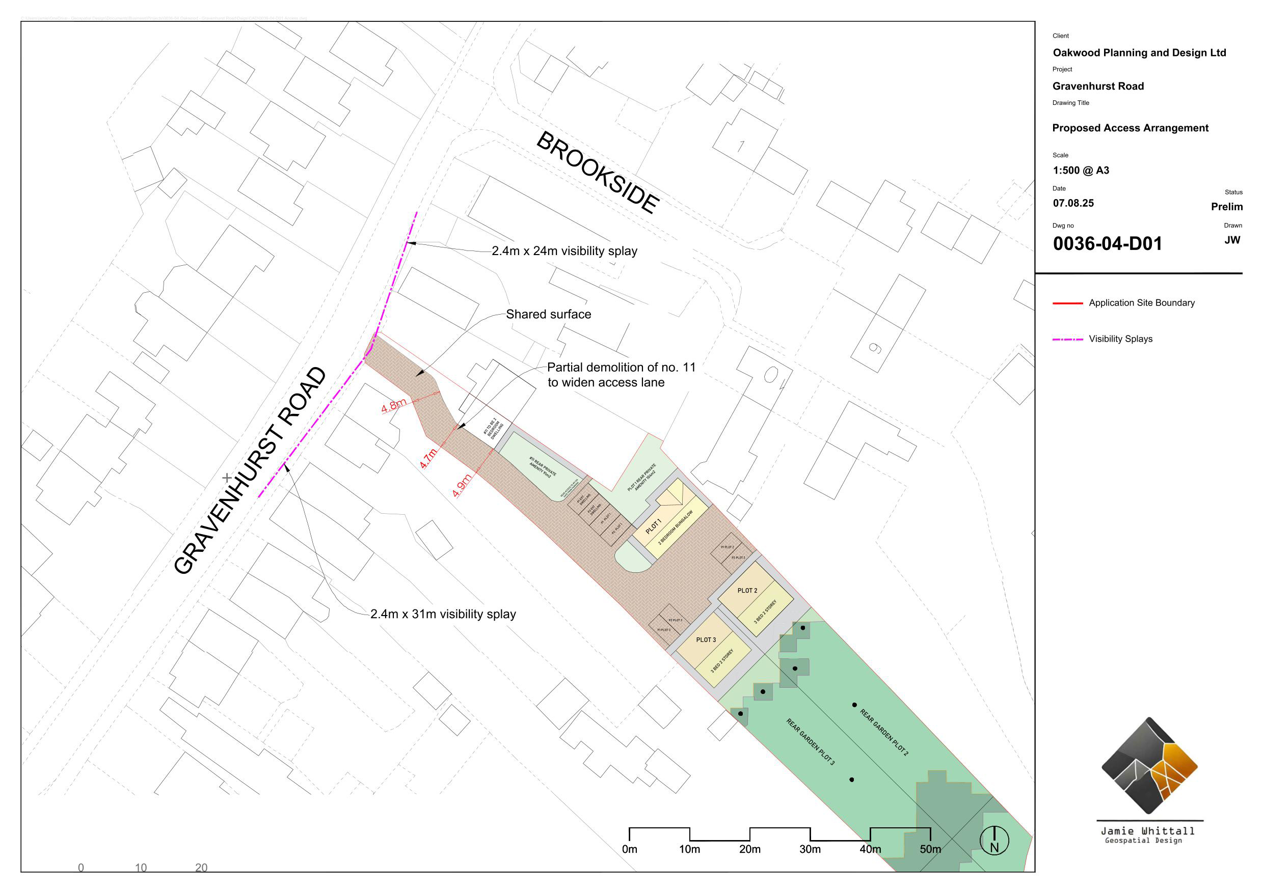
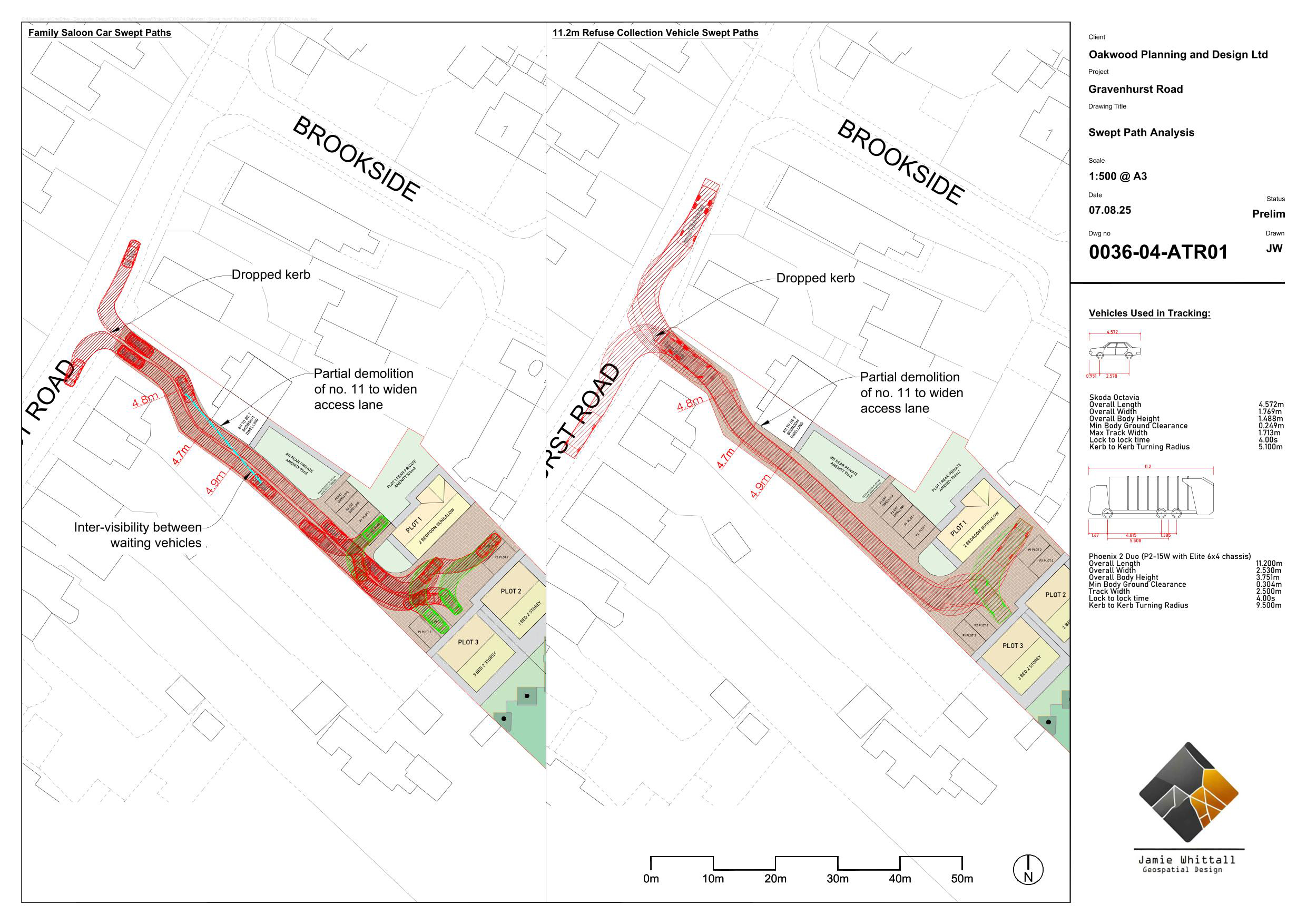
A 3-dwelling residential scheme required a new access to be formed alongside existing buildings. The position of these buildings limited space and meant a standard access solution wasn’t possible.
The Approach
Rather than suggesting a rigid adoptable road, I developed a shared private access arrangement, in accordance with technical design guidance for the authority. This required less width and would be appropriate for small developments with low vehicle movements. The layout allowed vehicles and pedestrians to share space safely, with low speeds and informal give-way where the access narrowed.
I assessed the maximum achievable visibility splays and compared these against requirements. This provided a clear and proportionate position that could be taken to pre-application stage, without commissioning surveys.
The access strategy was set out in a Highways Scoping Note. This included calculations to show that vehicle interactions along the access would be very unlikely.
The Outcome
The work demonstrated that a safe and workable access solution could be achieved despite the constraints. Without this approach, the site could not have been brought forward.
The Work
Example 3: QGIS Training for Planning Teams
The Challenge
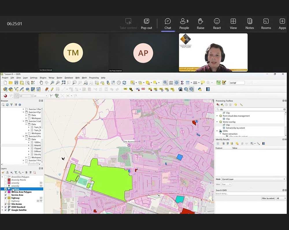
Link Transport Planning wanted to reduce reliance on specialist GIS support and take more of their mapping projects in-house. The end-goal was to produce walking and cycling catchments of their own and offer those products to clients.
While GIS was already used occasionally, there was no experience of best practice, repeatable workflows, or how to manage data in a shared environment. These are challenges common to many planning consultancies.
The Approach
I delivered a tailored QGIS training course structured around their specific planning needs. The session focused on the practical skills they needed, including working with common datasets, producing professional report-ready maps, managing symbology, and using processing tools.
Rather than relying on out-of-the-box plugins, the emphasis was on understanding how GIS works so outputs can be trusted, checked, and reused across multiple projects. The course was paced to build confidence quickly without overwhelming participants or assuming any prior QGIS experience.
The Outcome
The Work
The Client
“The training was excellent. We really appreciate you putting together a bespoke session that was extremely well organised, engaging, and delivered with clarity throughout.”
Joseph Cassinelli (Director – Link Transport Planning)
“Jamie broke down the components of QGIS for us, while explaining how to build towards a useful goal. He did this at a good pace which condensed the course into a day and kept everyone engaged, while also ensuring we never got left behind. It was an incredibly useful, practical and well-explained introduction to QGIS. I will now be able to do much more of the graphical work on our reports rather than asking other team members to do it.”
Tom Morris (Transport Planner – Link Transport Planning)
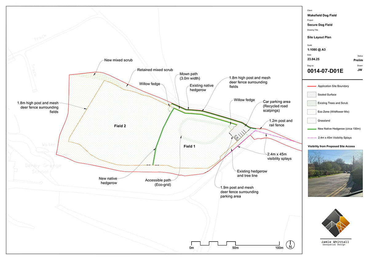
Example 4: Rural Diversification
The Challenge
This project is part of a large portfolio of secure dog field and rural diversification schemes I am involved with. The client needed a suite of drawings covering the access, visibility and layout.
In this case, the Local Highway Authority requested a very severe visibility splay based on the 60mph posted speed limit of the nearby highway. This was not achievable in practice because of the alignment of the road and could result in a highways objection.
The Approach
Working alongside long-term collaborators at Evolve Planning & Design, I produced a suite of planning drawings, including the site layout, existing layout, elevations and visibility splays.
As this was a private access road, I suggested that actual vehicle speeds would be significantly lower and a more easily achievable visibility splay would be appropriate. The focus was on clearly explaining how the site would operate and demonstrating that access and visibility could be achieved in a safe way whilst reducing any planning burdens for the developer.
The Outcome
The access and visibility arrangements were accepted by the Local Highway Authority. The drawings provided a clear way forwards that supported the wider case for rural diversification and ultimately led to a successful planning application.
The Work
The Client
“Efficiency, reliability and quality is what you get with Jamie. Whenever I need a drawing prepared, I know he will pull together exactly what I need and when I need it. He is very friendly, approachable and willing, with his expertise adding significant value to my projects.”
Stuart Wells (Director – Evolve Planning and Design)